Course
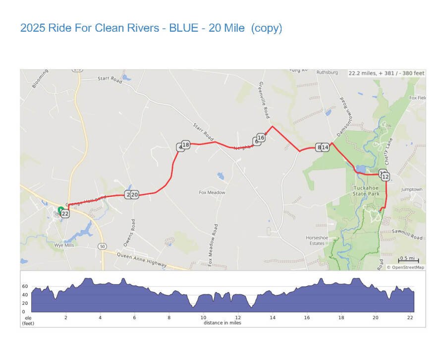
20 Mile Route (Blue)

Registration for the next edition has not opened.
We earn a small commission when you register through this link, at no cost to you. Details
1000 College Circle, Wye Mills, MD 21679
The pin marks the address the race lists, which is usually the start. Course maps are the organizers' own.
The 62-mile bike course climbs 1,106 feet, about 18 feet a mile: flat.
| Course | Distance | Climbing | Terrain |
|---|---|---|---|
| 2025 Ride For Clean Rivers -RED - 62 Mile (copy)Bike, loop | 62 mi | 1,106 ft | flat |
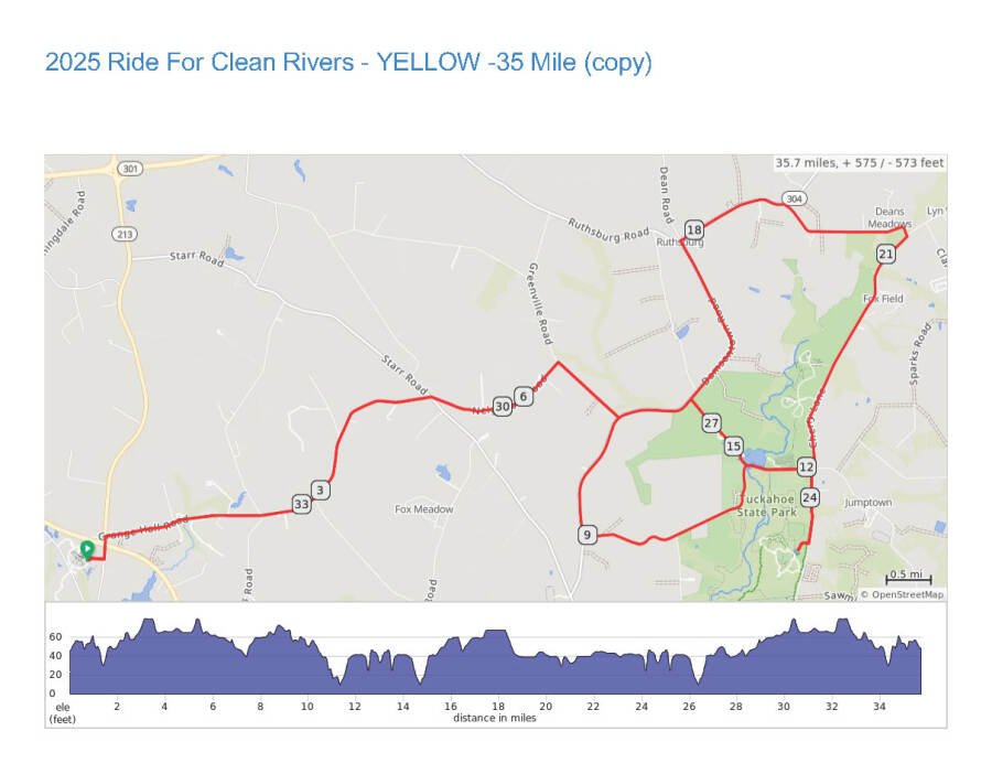
| 2025 Ride For Clean Rivers - YELLOW -35 Mile (copy)Bike, loop | 36 mi | 576 ft | flat |
| 2025 Ride For Clean Rivers - BLUE - 20 Mile (copy)Bike, out and back | 22 mi | 382 ft | flat |
From the course maps the organizers publish on Ride with GPS and MapMyRun; climbing is the total gain the map reports. Courses can change between editions, so check the date on the map.
National lists computed from results, entry fees, course maps and water temperatures; they refresh through the day.
What the organizers of ShoreRivers Ride for Clean Rivers cover on their registration page, in brief.
Course
Course
Course

Parking and travel
All of our courses are available on RIDE WITH GPS with no paid account necessary. We provide you with the option of having turn by turn directions, right on your phone, with our Organization account! You can find the entire event tab at…
Organize this race? Add details or a correction
Celebrate over 20 years of riding for clean rivers! ShoreRivers is grateful to all the cyclists and supporters who have joined us over two decades to bring funding and awareness to local and regional clean water efforts. Ride the beautiful back roads of Talbot and Queen Anne’s Counties in support of ShoreRivers’ work for clean waterways. This is a great way to bring summer to a close surrounded by friends, family, and fellow community members. Riders are also encouraged to join teams and create their own fundraising pages to boost support for their participation from others.